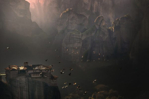
The mountain that built the Parthenon. Mount Penteli's ancient marble quarries supplied the luminous white stone for the Acropolis, and today the mountain offers forested hiking trails, quiet monasteries, and a glimpse into the industrial backbone of Classical Athens -- all 30 minutes from the city centre.
In this guide
Mount Penteli (1,109m) sits northeast of Athens, between Parnitha to the west and Hymettus to the south. It's the second-highest of the Athens mountains and the most densely forested after Parnitha, with pine and fir covering its slopes. But its real claim to fame is the marble: Pentelic marble, a fine-grained white stone with a faint golden hue caused by iron traces, was quarried here for millennia and used to build Athens' most important monuments.
The Marble Connection
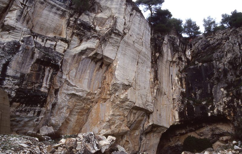
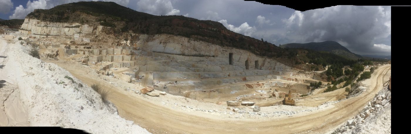
The quarries on Penteli's southern slopes have been active since at least the 6th century BC. The Parthenon, the Temple of Olympian Zeus, the Ancient Agora buildings, and many other Athenian monuments were built with Pentelic marble. The stone was transported to Athens on an ancient road, parts of which are still traceable.
What makes Pentelic marble special is its unique luminosity. The iron content means it develops a warm, golden patina over time -- which is why the Parthenon glows in the sunset light. Fresh-cut Pentelic marble is stark white; aged Pentelic marble is honeyed gold.
The quarries are still partially visible on the mountainside, though modern quarrying has altered the landscape. Some ancient quarry faces, with their distinctive extraction marks, can still be seen along hiking trails.
How Do You Get There From Athens?
By car: Drive to Penteli village (about 25 minutes from central Athens) and continue to the Penteli Monastery or the quarry area. Free parking at the monastery and at several trailheads.
By bus: Bus 444 from Doukissis Plakentias metro station (Blue Line) towards Penteli village. From the village, it's a 20-minute walk uphill to the monastery and trail start.
By taxi: About 15-20 EUR from central Athens to the monastery.
Key Starting Points
Penteli Monastery (500m) -- The main starting point. A 17th-century monastery with a courtyard, church, and surrounding pine forest. Several trails depart from the area around the monastery.
Ntrafi (Drafi) side -- Access from the eastern side, near Pallini. Quieter trails through forest.
Ancient quarry area -- Higher on the southern slope, accessible by forest road from the monastery.
Best Hikes
Monastery Forest Loop (Easy)
Distance: 3-5 km | Time: 1-1.5 hours | Difficulty: Easy
Gentle paths through the pine forest around the monastery. Shaded, flat to gently undulating. Good for families, casual walkers, and hot days when you want tree cover. The forest here is dense and pleasant.
Ancient Quarries Trail (Moderate)
Distance: 6-8 km round trip | Time: 2.5-3 hours | Difficulty: Moderate
From the monastery area, climb through forest to the ancient marble quarry zone on the southern face. You'll see exposed quarry faces with extraction marks dating back over 2,000 years. The views south over Athens and the Saronic Gulf open up as you gain altitude. The trail passes through transitional terrain -- forest gives way to scrub and exposed rock.
Summit Trail (Challenging)
Distance: 10-12 km round trip | Time: 4-5 hours | Difficulty: Challenging
The full ascent to the 1,109m summit. Mixed terrain through forest, scrub, and open hillside. The upper reaches are exposed and windy. Views from the top extend across the Attic plain to Evia and the sea. Less dramatic than Parnitha's summit but more accessible.
Penteli to Amygdaleza (Moderate)
Distance: 8 km one way | Time: 3 hours | Difficulty: Moderate
A traverse across the northern slopes connecting Penteli to the Amygdaleza area. Through forest with occasional clearings and viewpoints. Can be done as a one-way hike with a taxi pickup at the other end.
What You'll See
Ancient quarries -- Exposed marble faces with tool marks from Classical-era extraction. Standing in the same quarry that supplied the Parthenon is a tangible connection to ancient Athens.
Running your hand over the ancient chisel marks in the quarry face, knowing this is where the Parthenon's marble came from, is one of those quiet Athens moments that stays with you.
Penteli Monastery -- 17th-century monastery, still active. The courtyard is open to visitors. Modest but peaceful.
Dense pine forest -- Penteli's lower and middle slopes are heavily forested, providing shade and cooler temperatures than the city below.
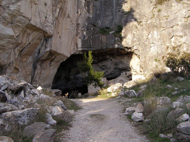
Cave of Penteli (Ntavelis Cave) -- A large cave on the northern slope, steeped in local folklore (tales of supernatural beings and secret passages). The cave itself is interesting but access varies -- check locally.
Views -- From the upper slopes and summit, panoramic views over Athens, the South Euboean Gulf to the east, and the neighbouring mountains (Parnitha, Hymettus).
What Should You Know Before Going?
- The forest makes Penteli good for hot days. Unlike exposed Hymettus, Penteli's lower and middle trails are shaded. In summer, it's noticeably cooler under the trees.
Penteli is the mountain I send people to when they want shade. The lower trails are completely canopied -- it can feel 10 degrees cooler than the city, even in August.
- Water: Carry your own. The monastery has water but trails above don't.
- The quarries require some route-finding. They're not on a single marked trail. A GPS app (Topoguide or AllTrails) helps.
- Penteli is popular with Athenian joggers and cyclists on weekday mornings. The forest roads are shared with occasional vehicles.
- Fire risk applies in summer. Check for restrictions before visiting in July-August.
Penteli vs Parnitha vs Hymettus
| Penteli | Parnitha | Hymettus | |
|---|---|---|---|
| Height | 1,109m | 1,413m | 1,026m |
| Character | Forested, marble quarries | Wild, national park | Open, scrubby |
| Best for | Forest walks, historical interest | Serious hiking, wildlife | City views, sunset |
| Distance from centre | 25 min | 45 min | 20 min |
Penteli sits between the other two in most respects -- more forested than Hymettus, more accessible than Parnitha. The quarries give it a unique historical angle.
When Is the Best Time to Visit?
Spring -- Green forest, wildflowers, comfortable temperatures.
Autumn -- Clear air, golden light through the pines.
Summer -- Stick to the shaded forest trails. Avoid the exposed upper slopes at midday.
Winter -- Mild enough for hiking. Occasionally gets light snow above 800m.
Mount Penteli is 20 km northeast of Athens, about 25 minutes by car. The Penteli Monastery is the main starting point for hikes.
Planning more adventures from the capital? Browse our complete guide to the best day trips from Athens.
Last updated: March 2026